In our quest to bring your more and more comprehensive vacation information for Canmore and Kananaskis Country, we’ve written up yet more of the many great Canadian Rockies hikes you’ll find in this area.

The hikes below offer a wide range of difficulty levels, so that pretty much anyone should be able to find something appealing. If, after reading this, you’re still not convinced about a trip to Canmore, be sure to take a gander at the Canmore webcam, where you can control the camera and take a good look at the town and surrounding mountains.
Cougar Creek
This creek bed makes a great hiking trail when it’s dry in the summer. What starts as a trail quickly turns into rocks on the dry creek bed, with the occasional puddle or small stream to cross. Be careful early in spring, as snow melt combined with spring rain greatly increases the water flow in the creek.
Difficulty: Easy
Total Round trip: about 4 km/2.5 miles
Elevation gain: almost none
Average time: 1.5 – 2 hours return
Location: Cougar Creek parking lot on Benchlands Trail
Heart Creek
ON this hike, you’ll follow the right fork at the first major junction. Here, you’ll find yourself following a wide gravel path up the creek bed. You’ll then cross the creek on seven log bridges. Spectacular views of the rock face of Mount McGillivray, as well as awesome views of Heart Mountain.
Difficulty: Easy
Total Round trip: 4 km/2.5 miles
Elevation gain: 100 m/328 feet
Average time: 1.5 hours return
Location: East of Canmore on the TransCanada Highway (Hwy 1). Travel towards Calgary (approximately 15 minutes) and take the Lac Des Arcs/ Heart Creek exit, then follow signs to the parking lot and trail head.
Grassi Lakes
This beautiful trail was named after its creator, Lawrence Grassi, a pioneer in Canmore’s hiking history. Grassi helped put together many of the area trails, and this was always one of his favourites. The hike takes you through the forest to 2 beautiful spring fed lakes. The trail then splits into two about 200 m into the hike, and they are labelled as “Easy” (this is a fire road- suitable for all levels) and “More Difficult” (a more narrow trail with occasional rocks, roots and other small obstacles on the trail, as well as a staircase near the end).
Difficulty: Moderate Walk/Light Hike
Total round trip: 3.8 km/2.4 miles
Elevation gain: 250 m/820 feet
Average time: 1.5 – 2 hours return
Location: Follow Spray Lakes Road 1.25 km past the Nordic Centre to the transition from pavement to gravel. Turn
left to reach the parking lot.
Grotto Canyon
Ignore the many side trails at the start of this hike. It shouldn’t be too long, 10 minutes tops, before you come to a significant dry river bed (this is not Grotto Canyon). The trail continues across the river bed just follow the sign with the hiker figure to find it.
Once on the west side of this dry gulch, carry on to the post with the red trail marker and follow the route indicated, which takes you past an industrial plant. Just west of the plant, the trail has a little elevation gain, and you will see a bench overlooking another river bed, with a spectacular lookout over Gap Lake and on to Canmore.
Turn right and you will be looking into the entrance of Grotto Canyon. Total walk time to this point is approximately 20 minutes. The walk into the canyon is breathtaking and awe inspiring, although if you don’t like tight spaces, you might find the canyon walls a bit clausterphobic.
Entering the canyon, look around carefully on the walls for the remaining pictographs. The first set are visible on the left, almost at eye level for most adults. Regretfully, most of the pictographs were vandalized or inadvertently ruined. Do not touch the pictographs as acids and oils in your skins will accelerate the deterioration of the artifacts.
Difficulty: Moderate Walk/Light Hike
Total round trip: 4 km/2.5 miles
Elevation gain: 50 m/154 feet
Average time: 1.5 – 2 hours return
Location: Follow Highway 1A (Bow Valley Trail) east out of Canmore for approximately 10 minutes to the Grotto Pond Day Use Area.
Ha Ling Peak
This short, sweet and steep trail will bring you to excellent viewpoints overlooking the town of Canmore. The majority of the trail switchbacks up a forested slope, but the final ascent is on shale and scree and some route finding may be required.
Difficulty: Steep Hiking/ Beginner Scramble
Total round trip: 5.6 km
Elevation gain: 700 m
Average time: 3 – 4 hours
Location: Goat Creek parking lot, located 5.5 km past the Nordic Centre along the gravel Spray Lakes Road/Smith Dorrien Highway. Walk across the road, past the green gate and over the bridge until you come to a small building. Just behind the building is the trailhead to Ha Ling Peak.
Lady MacDonald
Follow the trail along Cougar Creek until coming to a trail to the left. The trail switchbacks through the forest up to the treeline. Just above treeline, you’ll see the remains of a teahouse that was being constructed but is now abandoned. Because the last
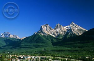
60 m of the hike is an exposed scramble along a narrow ridge, many people end the hike here, and enjoy the spectacular views of Canmore and the Three Sisters. If you decide to go to the summit ridge, you’ll gain approximately 275 m of elevation over 60 m.
Difficulty: Steep Hiking/Beginner Scramble
Total round trip: 8 km
Elevation gain: 850 m
Average time: 4. 5 – 7 hours
Location: Cougar Creek parking lot on Benchlands Trail


Be First to Comment